
Thank you for supporting this site ❤️
Make a donation
Make a donation
Gear up for your next adventure:
As an Amazon Associate, this site earns from qualifying purchases at no extra cost to you.
Tlalchy topographic map
Click on the map to display elevation.
Thank you for supporting this site ❤️
Make a donation
Make a donation
Gear up for your next adventure:
As an Amazon Associate, this site earns from qualifying purchases at no extra cost to you.
About this map
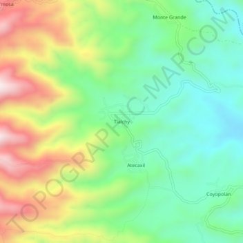
Name: Tlalchy topographic map, elevation, terrain.
Location: Tlalchy, Ixhuacán de los Reyes, Veracruz, Mexico (19.36083 -97.09889 19.40083 -97.05889)
Average elevation: 1,684 m
Minimum elevation: 1,448 m
Maximum elevation: 2,078 m
Thank you for supporting this site ❤️
Make a donation
Make a donation
Gear up for your next adventure:
As an Amazon Associate, this site earns from qualifying purchases at no extra cost to you.