
Ciudad Adolfo Lopez Mateos topographic map
Interactive map
Click on the map to display elevation.
Ciudad Adolfo Lopez Mateos
Its main elevations are Biznaga Hill, Atlaco Hill La Condesa Hill and Grande Hill.
About this map
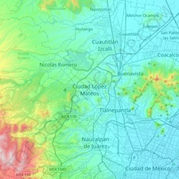
Name: Ciudad Adolfo Lopez Mateos topographic map, elevation, terrain.
Average elevation: 2,426 m
Minimum elevation: 2,222 m
Maximum elevation: 3,514 m