
Cabrier topographic map
Interactive map
Click on the map to display elevation.
About this map
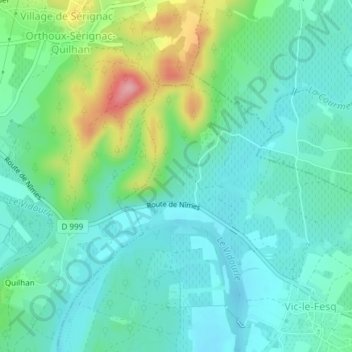
Name: Cabrier topographic map, elevation, terrain.
Average elevation: 71 m
Minimum elevation: 38 m
Maximum elevation: 166 m
Other topographic maps
Click on a map to view its topography, its elevation and its terrain.
Vialat
France > Occitanie > Gard > Vic-le-Fesq
Vialat, Lotissement la Cigale, Vic-le-Fesq, Le Vigan, Gard, Occitanie, France métropolitaine, 30260, France
Average elevation: 77 m