
Jerstedt topographic map
Interactive map
Click on the map to display elevation.
About this map
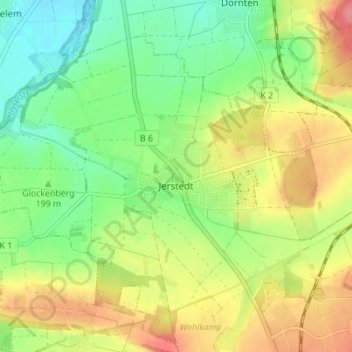
Name: Jerstedt topographic map, elevation, terrain.
Location: Jerstedt, Goslar, Landkreis Goslar, Niedersachsen, Deutschland (51.93582 10.34654 51.96991 10.41560)
Average elevation: 205 m
Minimum elevation: 169 m
Maximum elevation: 252 m