Geolocate

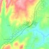
Freches topographic map

Click on the map to display elevation.

About this map

Name: Freches topographic map, elevation, terrain.

Location: Freches, Trancoso, Guarda, 6420-414, Portugal (40.70209 -7.37601 40.74366 -7.33074)

Average elevation: 580 m

Minimum elevation: 427 m

Maximum elevation: 813 m

Other topographic maps

Click on a map to view its topography, its elevation and its terrain.
São Clemente

Portugal > Guarda > Trancoso

Average elevation: 594 m

A-dos-Ferreiros

Portugal > Guarda > Trancoso > Cótimos

Average elevation: 570 m

Gear up for your next adventure:

🧼Camping Hygiene Kits - Compact hygiene essentials for outdoor stays
🛌Sleeping Bags - Warm and packable sleeping bags for outdoor nights
🔦Outdoor Torches - Reliable torches for night navigation
📍Handheld GPS Navigators - Reliable satellite navigation for hiking and off-road exploration
👟Women's Trail Running Shoes - Agile footwear for fell running and technical trails

As an Amazon Associate, this site earns from qualifying purchases at no extra cost to you.