
Kira topographic map
Interactive map
Click on the map to display elevation.
About this map
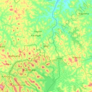
Name: Kira topographic map, elevation, terrain.
Location: Kira, Wakiso, Central Region, Uganda (0.24034 32.47918 0.56034 32.79918)
Average elevation: 1,165 m
Minimum elevation: 1,086 m
Maximum elevation: 1,333 m
Other topographic maps
Click on a map to view its topography, its elevation and its terrain.