
Dayton Township topographic map
Interactive map
Click on the map to display elevation.
About this map
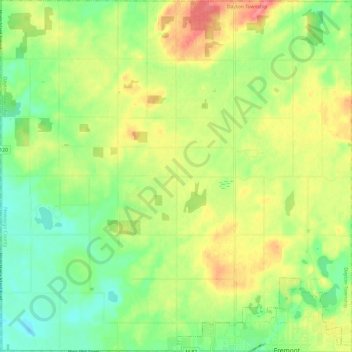
Name: Dayton Township topographic map, elevation, terrain.
Location: Dayton Township, Newaygo County, Michigan, United States (43.46722 -86.03978 43.55407 -85.91996)
Average elevation: 257 m
Minimum elevation: 224 m
Maximum elevation: 299 m
Other topographic maps
Click on a map to view its topography, its elevation and its terrain.