
Ahrntal - Valle Aurina topographic map
Interactive map
Click on the map to display elevation.
Ahrntal - Valle Aurina
Weißenbach is composed of picturesque Alpine farmhouses, grouped around the foaming white glacial stream from which its name is derived. With a population of around 550, it has an elevation of 1,350 metres (4,430 ft) above sea level.
About this map
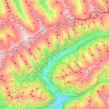
Name: Ahrntal - Valle Aurina topographic map, elevation, terrain.
Average elevation: 2,079 m
Minimum elevation: 851 m
Maximum elevation: 3,359 m
Other topographic maps
Click on a map to view its topography, its elevation and its terrain.
Bolzano - Bozen
Italy > Trentino – Alto Adige/Südtirol > South Tyrol
The area of the city of Bolzano is 52.3 km2 (20 sq. mi.), of which 28 km2 (10 sq. mi.) is used as a settlement area. The city is located in the basin where the Sarntal, Eisacktal, and the Adige Valley with their rivers, Talfer, Eisack, and Adige, meet. In the Middle Ages, the two main Alpine crossings, the Via…
Average elevation: 716 m
Mühlbach - Rio di Pusteria
Italy > Trentino – Alto Adige/Südtirol > South Tyrol
Average elevation: 1,737 m
Seiser Alm-Gruppe - Gruppo Mont de Sëuc - Gruppo dell'Alpe di Siusi
Italy > Trentino – Alto Adige/Südtirol > South Tyrol > Kastelruth - Castelrotto
Seiser Alm (Italian: Alpe di Siusi, Ladin: Mont Sëuc) is a Dolomite plateau and the largest high-elevation Alpine meadow (German: Alm) in Europe. Located in Italy's South Tyrol province in the Dolomites mountain range, it is a major tourist attraction, notably for skiing and hiking.
Average elevation: 1,466 m
Afers - Eores
Italy > Trentino – Alto Adige/Südtirol > South Tyrol > Brixen - Bressanone
Average elevation: 1,632 m
Klobenstein - Collalbo
Italy > Trentino – Alto Adige/Südtirol > South Tyrol > Ritten - Renon
Average elevation: 1,135 m
Corvara in Badia - Corvara
Italy > Trentino – Alto Adige/Südtirol > South Tyrol
Average elevation: 2,037 m
Gnates
Italy > Trentino – Alto Adige/Südtirol > South Tyrol > La Val - Wengen - La Valle
Average elevation: 1,504 m
Gisse
Italy > Trentino – Alto Adige/Südtirol > South Tyrol > Ahrntal - Valle Aurina
Average elevation: 1,368 m
Meransen - Maranza
Italy > Trentino – Alto Adige/Südtirol > South Tyrol
Meransen (Italian: Maranza) is a village in South Tyrol, Italy, in the Mühlbach municipality between Pustertal and Eisacktal. It located on the slopes of the Gitschberg mountain at an altitude of 1,414 m (4,639 ft).
Average elevation: 1,279 m
Wahlen - Valle San Silvestro
Italy > Trentino – Alto Adige/Südtirol > South Tyrol
Average elevation: 1,489 m
St. Anton
Italy > Trentino – Alto Adige/Südtirol > South Tyrol > Völs am Schlern - Fiè allo Sciliar
Average elevation: 804 m
Armentarola
Italy > Trentino – Alto Adige/Südtirol > South Tyrol > Badia - Abtei
Average elevation: 1,886 m
Lengstein - Longostagno
Italy > Trentino – Alto Adige/Südtirol > South Tyrol > Ritten - Renon
Average elevation: 937 m
Pfitsch - Val di Vizze
Italy > Trentino – Alto Adige/Südtirol > South Tyrol
Average elevation: 1,953 m
Thal
Italy > Trentino – Alto Adige/Südtirol > South Tyrol > Martell - Martello
Average elevation: 1,726 m
Piz Boè
Italy > Trentino – Alto Adige/Südtirol > South Tyrol > Corvara in Badia - Corvara
Piz Boè is the highest mountain of the Sella group, a mountain range in the Dolomites, Italy. It has an elevation of 3,152 metres (10,341 ft).
Average elevation: 2,664 m
Prämajur
Italy > Trentino – Alto Adige/Südtirol > South Tyrol > Schleis - Clusio
Average elevation: 1,614 m
Eppan an der Weinstraße - Appiano sulla Strada del Vino
Italy > Trentino – Alto Adige/Südtirol > South Tyrol
Average elevation: 701 m
Milland - Millan
Italy > Trentino – Alto Adige/Südtirol > South Tyrol > Brixen - Bressanone
Average elevation: 769 m
Hafling - Avelengo
Italy > Trentino – Alto Adige/Südtirol > South Tyrol
The emblem is a natural breed Haflinger horse on a mountain with three vert peaks, through a pine tree. The mountain and the pine symbolize that the village is located at high elevation. The coat of arms was granted in 1967.
Average elevation: 1,228 m
Saslonch - Langkofel - Sassolungo
Italy > Trentino – Alto Adige/Südtirol > South Tyrol > Sëlva - Wolkenstein - Selva di Val Gardena
Average elevation: 2,320 m
Neuwies - Pratonuovo
Italy > Trentino – Alto Adige/Südtirol > South Tyrol > Stilfs - Stelvio > Trafoi
Average elevation: 2,088 m
Sëlva - Wolkenstein - Selva di Val Gardena
Italy > Trentino – Alto Adige/Südtirol > South Tyrol
Sëlva is characterized by a typical Alpine climate. Summers are rather short and relatively wet. The average daily temperatures in summer lie between 18 and 21 °C, while at night temperatures usually drop to between 6 and 9 °C. Winters are typically cold, long and relatively dry. The average daily…
Average elevation: 2,146 m
Weitental - Vallarga
Italy > Trentino – Alto Adige/Südtirol > South Tyrol > Vintl - Vandoies
Average elevation: 1,306 m
Kastelruth - Castelrotto
Italy > Trentino – Alto Adige/Südtirol > South Tyrol
Average elevation: 1,561 m
Meran - Merano
Italy > Trentino – Alto Adige/Südtirol > South Tyrol
The average daily temperatures in summer in Merano lie between 27 and 30 °C, while at night temperatures usually drop to between 12 and 15 °C. The average daily temperatures in winter lie between 6 and 10 °C, while at night temperatures usually drop to between -4 and -2 °C. The wettest month is August with…
Average elevation: 635 m
Gherdëina - Grödnertal - Val Gardena
Italy > Trentino – Alto Adige/Südtirol > South Tyrol > Urtijëi - St. Ulrich in Gröden - Ortisei
Average elevation: 1,588 m
Urtijëi - St. Ulrich in Gröden - Ortisei
Italy > Trentino – Alto Adige/Südtirol > South Tyrol
Average elevation: 1,689 m
Rasen-Antholz - Rasun-Anterselva
Italy > Trentino – Alto Adige/Südtirol > South Tyrol
Rasen-Antholz is known for the South Tyrol Arena biathlon track, which opened in 1971. It hosted the Biathlon World Championships in 1975, 1976, 1983, 1995, 2007 and 2020. It is also a regular venue of the Biathlon World Cup season, with the highest altitude of all World Cup meetings at a height of about 1,600…
Average elevation: 1,934 m
Santa Cristina Gherdëina - St. Christina in Gröden - Santa Cristina Valgardena
Italy > Trentino – Alto Adige/Südtirol > South Tyrol
Average elevation: 1,935 m
Bruneck - Brunico
Italy > Trentino – Alto Adige/Südtirol > South Tyrol
Bruneck rises up in the middle of a wide valley (perhaps an ancient lake basin) and lies at the confluence of the Ahr with the Rienz, which itself flows into the Eisack river. Here the northern Tauferer Ahrntal side valley and the southern Val Badia of the Gran Ega creek join the broad Pustertal. Bruneck wide…
Average elevation: 1,251 m
Ortler - Ortles
Italy > Trentino – Alto Adige/Südtirol > South Tyrol > Stilfs - Stelvio
The Ortler was first climbed by Josef Pichler [de] ("Pseirer-Josele"), a chamois hunter from St. Leonhard in Passeier, and his companions Johann Leitner and Johann Klausner from Zell am Ziller on 27 September 1804. The ascent had been a request of Archduke Johann of Austria, who felt strongly that after the…
Average elevation: 3,175 m