
Kleine Striegis topographic map
Interactive map
Click on the map to display elevation.
About this map
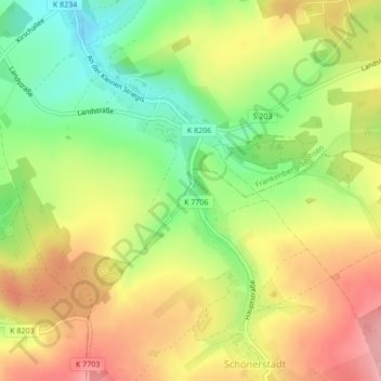
Name: Kleine Striegis topographic map, elevation, terrain.
Location: Kleine Striegis, Oederan, Mittelsachsen, Sachsen, Deutschland (50.89404 13.13383 50.89457 13.13441)
Average elevation: 434 m
Minimum elevation: 370 m
Maximum elevation: 495 m