
Thank you for supporting this site ❤️
Make a donation
Make a donation
Gear up for your next adventure:
As an Amazon Associate, this site earns from qualifying purchases at no extra cost to you.
Gulabgarh topographic map
Click on the map to display elevation.
Thank you for supporting this site ❤️
Make a donation
Make a donation
Gear up for your next adventure:
As an Amazon Associate, this site earns from qualifying purchases at no extra cost to you.
About this map
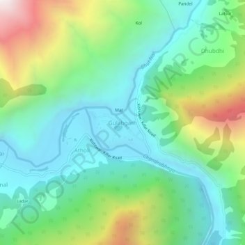
Name: Gulabgarh topographic map, elevation, terrain.
Location: Gulabgarh, Atholi (Paddar), Kishtwar, Jammu and Kashmir, India (33.24902 76.15106 33.28902 76.19106)
Average elevation: 2,225 m
Minimum elevation: 1,780 m
Maximum elevation: 3,295 m
Thank you for supporting this site ❤️
Make a donation
Make a donation
Gear up for your next adventure:
As an Amazon Associate, this site earns from qualifying purchases at no extra cost to you.