St. Mary's Island topographic map
Interactive map
Click on the map to display elevation.
About this map
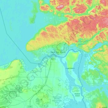
Name: St. Mary's Island topographic map, elevation, terrain.
Average elevation: 239 m
Minimum elevation: 173 m
Maximum elevation: 569 m

Click on the map to display elevation.
Name: St. Mary's Island topographic map, elevation, terrain.
Average elevation: 239 m
Minimum elevation: 173 m
Maximum elevation: 569 m