
Old Town topographic map
Interactive map
Click on the map to display elevation.
About this map
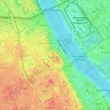
Name: Old Town topographic map, elevation, terrain.
Location: Old Town, Midtown, Warsaw, Masovian Voivodeship, Poland (52.24653 21.00618 52.25352 21.02102)
Average elevation: 98 m
Minimum elevation: 73 m
Maximum elevation: 123 m
Other topographic maps
Click on a map to view its topography, its elevation and its terrain.