Geolocate

Karon topographic map

Click on the map to display elevation.

About this map

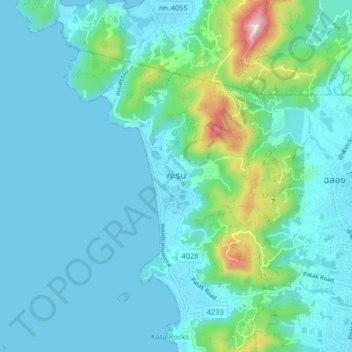
Name: Karon topographic map, elevation, terrain.

Location: Karon, Mueang Phuket, Phuket Province, 83100, Thailand (7.80752 98.25811 7.88752 98.33811)

Average elevation: 75 m

Minimum elevation: -1 m

Maximum elevation: 508 m

Other topographic maps

Click on a map to view its topography, its elevation and its terrain.

Freedom Beach

Thailand > Mueang Phuket > Karon

Average elevation: 46 m

Gear up for your next adventure:

🍳Camping Stoves - Compact stoves for outdoor cooking
🎿Telescopic Trekking Poles - Reduces knee strain on steep topographic descents
Altimeter Watches - Watches measuring altitude for mountain activities
🧤Hiking Gloves - Warm and durable gloves for cold-weather walks
📚UK Hiking Guidebooks - Detailed route descriptions for the Lake District, Peaks, and Highlands

As an Amazon Associate, this site earns from qualifying purchases at no extra cost to you.