Geolocate

Valleyview (town) topographic map

Click on the map to display elevation.

About this map

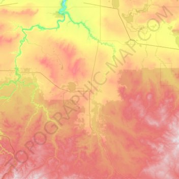
Name: Valleyview (town) topographic map, elevation, terrain.

Location: Valleyview (town), Alberta, T0H 0C8, Canada (54.37463 -117.97981 55.77463 -116.57981)

Average elevation: 725 m

Minimum elevation: 372 m

Maximum elevation: 1,221 m

Gear up for your next adventure:

📍Handheld GPS Navigators - Reliable satellite navigation for hiking and off-road exploration
🛑Emergency Bivvy Bags - Heat-reflective survival bags for unexpected nights out
🧴Tick Removal Tools - Small, essential health tool for UK woodland and moorland
🎒Replacement Sternum Straps - Repair parts for hiking rucksacks
🧥Breathable Waterproof Jackets - Essential rain protection for the unpredictable British climate

As an Amazon Associate, this site earns from qualifying purchases at no extra cost to you.