Geolocate

Guthrie topographic map

Click on the map to display elevation.

About this map

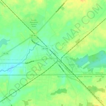
Name: Guthrie topographic map, elevation, terrain.

Location: Guthrie, Todd County, Kentucky, United States (36.64198 -87.20007 36.65920 -87.14833)

Average elevation: 172 m

Minimum elevation: 157 m

Maximum elevation: 187 m

Gear up for your next adventure:

🧭Orienteering Compasses - Accurate compasses for map-based navigation
📻Hand-Crank Emergency Radios - Stay updated on weather warnings in remote areas
🔋Lithium AA Batteries - Long-lasting power that performs well in cold mountain weather
🛌Sleeping Bags - Warm and packable sleeping bags for outdoor nights
🚲Cycling GPS Computers - Track elevation and topographic routes on two wheels

As an Amazon Associate, this site earns from qualifying purchases at no extra cost to you.