
Ban Huai Na topographic map
Interactive map
Click on the map to display elevation.
About this map
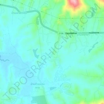
Name: Ban Huai Na topographic map, elevation, terrain.
Location: Ban Huai Na, Phetchabun Province, 67280, Thailand (16.74172 101.00229 16.78172 101.04229)
Average elevation: 723 m
Minimum elevation: 692 m
Maximum elevation: 870 m