
Make a donation
Gear up for your next adventure:
As an Amazon Associate, this site earns from qualifying purchases at no extra cost to you.
Unorganized Division No. 21 topographic map
Click on the map to display elevation.
Make a donation
Gear up for your next adventure:
As an Amazon Associate, this site earns from qualifying purchases at no extra cost to you.
About this map
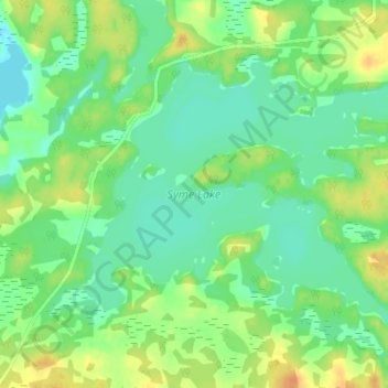
Name: Unorganized Division No. 21 topographic map, elevation, terrain.
Average elevation: 333 m
Minimum elevation: 320 m
Maximum elevation: 352 m
Make a donation
Gear up for your next adventure:
As an Amazon Associate, this site earns from qualifying purchases at no extra cost to you.
Other topographic maps
Click on a map to view its topography, its elevation and its terrain.
Bakers Narrows
Canada > Manitoba > Division No. 21 > Unorganized Division No. 21
Average elevation: 297 m
Easterville
Canada > Manitoba > Division No. 21 > Unorganized Division No. 21
Average elevation: 260 m
Make a donation
Gear up for your next adventure:
As an Amazon Associate, this site earns from qualifying purchases at no extra cost to you.