Geolocate

Bucuru topographic map

Click on the map to display elevation.

About this map

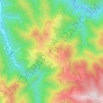
Name: Bucuru topographic map, elevation, terrain.

Location: Bucuru, Cugir, Alba, 515602, Romania (45.76879 23.37851 45.80879 23.41851)

Average elevation: 692 m

Minimum elevation: 352 m

Maximum elevation: 1,119 m

Gear up for your next adventure:

📱Rugged Phone Cases - Heavy-duty protection for smartphones used as secondary GPS tools
🔦LED Camping Lanterns - Illumination for reading maps inside your tent at night
🗺️Topographic Maps - Detailed maps showing elevation and terrain features
🧷Tenacious Repair Tape - Instant fix for torn tents, jackets, or dry bags
Lightweight Tents - Compact tents for backpacking and trekking

As an Amazon Associate, this site earns from qualifying purchases at no extra cost to you.