
Ngancar topographic map
Interactive map
Click on the map to display elevation.
About this map
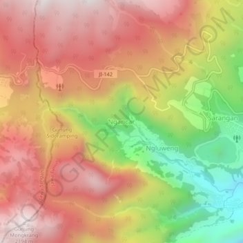
Name: Ngancar topographic map, elevation, terrain.
Location: Ngancar, Magetan, East Java, Java, Indonesia (-7.69267 111.18209 -7.65267 111.22209)
Average elevation: 1,715 m
Minimum elevation: 1,070 m
Maximum elevation: 2,176 m
Other topographic maps
Click on a map to view its topography, its elevation and its terrain.