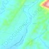
Senaki topographic map
Click on the map to display elevation.
Senaki
Senaki (Georgian: სენაკი, senak'i; Mingrelian: სანაკი, sanak'i) is a city in Samegrelo-Zemo Svaneti region, western Georgia. It is located at around 42°16′8″N 42°4′45″E / 42.26889°N 42.07917°E / 42.26889; 42.07917 between the rivers Tekhura/i and Tsivi, at an elevation of 28–38 meters above sea level. Senaki is the center of the Senaki Municipality and serves as a residence of Metropolitans of Senaki and Ckhorotskhu Eparchy of the Georgian Apostolic Autocephalous Orthodox Church.
About this map

Name: Senaki topographic map, elevation, terrain.
Location: Senaki, Senaki Municipality, Samegrelo-Upper Svaneti, Georgia (42.25909 42.03766 42.28315 42.09773)
Average elevation: 80 m
Minimum elevation: 14 m
Maximum elevation: 412 m
Other topographic maps
Click on a map to view its topography, its elevation and its terrain.