
Hobscheid topographic map
Interactive map
Click on the map to display elevation.
About this map
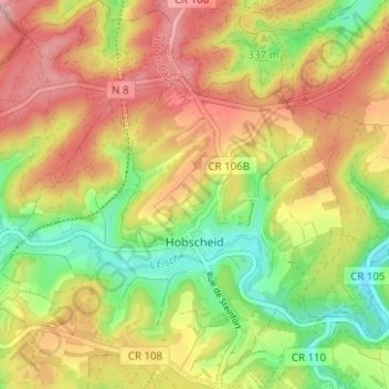
Name: Hobscheid topographic map, elevation, terrain.
Location: Hobscheid, Habscht, Canton Capellen, Luxembourg (49.67253 5.88499 49.71288 5.94422)
Average elevation: 335 m
Minimum elevation: 258 m
Maximum elevation: 401 m
Other topographic maps
Click on a map to view its topography, its elevation and its terrain.
Roodt-sur-Eisch
Luxembourg > Canton Capellen > Habscht > Roodt-sur-Eisch
Roodt-sur-Eisch, Habscht, Canton Capellen, 8398, Luxembourg
Average elevation: 325 m