
Rommerz topographic map
Interactive map
Click on the map to display elevation.
About this map
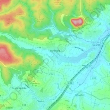
Name: Rommerz topographic map, elevation, terrain.
Location: Rommerz, Neuhof, Landkreis Fulda, Hessen, Deutschland (50.43160 9.49642 50.46588 9.59290)
Average elevation: 327 m
Minimum elevation: 270 m
Maximum elevation: 500 m
Other topographic maps
Click on a map to view its topography, its elevation and its terrain.
Hünfeld
Deutschland > Hessen > Landkreis Fulda
Hünfeld, Landkreis Fulda, Hessen, 36088, Deutschland
Average elevation: 362 m
Tann (Rhön)
Deutschland > Hessen > Landkreis Fulda
Tann (Rhön), Landkreis Fulda, Hessen, 36142, Deutschland
Average elevation: 504 m
Fulda
Deutschland > Hessen > Landkreis Fulda > Fulda
Fulda, Landkreis Fulda, Hessen, Deutschland
Average elevation: 324 m