Geolocate

Puan topographic map

Click on the map to display elevation.

About this map

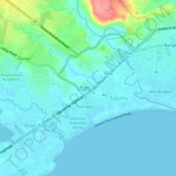
Name: Puan topographic map, elevation, terrain.

Location: Puan, Davao City, Davao Region, 8023, Philippines (7.03150 125.52080 7.07150 125.56080)

Average elevation: 15 m

Minimum elevation: -1 m

Maximum elevation: 95 m

Gear up for your next adventure:

🧢Waterproof Hiking Hats - Keep the rain off your face while studying topographic maps
🧤Hiking Gloves - Warm and durable gloves for cold-weather walks
🧊Insulated Flasks - Keeps drinks hot or cold during hikes
🧤Waterproof Overmitts - Extreme weather protection for hikers and mountaineers
❄️Walking Crampons - Added traction for icy slopes and winter peak bagging

As an Amazon Associate, this site earns from qualifying purchases at no extra cost to you.