
Thank you for supporting this site ❤️
Make a donation
Make a donation
Gear up for your next adventure:
As an Amazon Associate, this site earns from qualifying purchases at no extra cost to you.
Pong Dam topographic map
Click on the map to display elevation.
Thank you for supporting this site ❤️
Make a donation
Make a donation
Gear up for your next adventure:
As an Amazon Associate, this site earns from qualifying purchases at no extra cost to you.
About this map
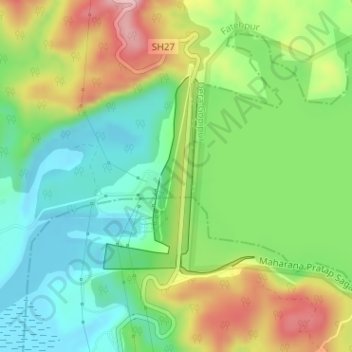
Name: Pong Dam topographic map, elevation, terrain.
Location: Pong Dam, Jaswan, Kangra, Himachal Pradesh, India (31.96324 75.93934 31.97857 75.95292)
Average elevation: 406 m
Minimum elevation: 329 m
Maximum elevation: 527 m
Thank you for supporting this site ❤️
Make a donation
Make a donation
Gear up for your next adventure:
As an Amazon Associate, this site earns from qualifying purchases at no extra cost to you.