Geolocate

Price topographic map

Click on the map to display elevation.

About this map

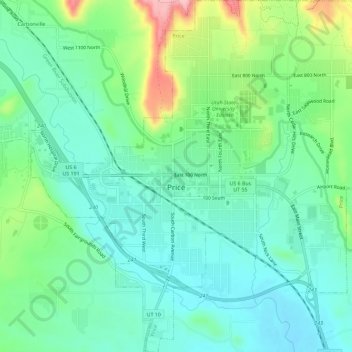
Name: Price topographic map, elevation, terrain.

Location: Price, Carbon County, Utah, United States (39.57867 -110.83472 39.62289 -110.77818)

Average elevation: 1,711 m

Minimum elevation: 1,666 m

Maximum elevation: 1,829 m

Gear up for your next adventure:

🧢Waterproof Hiking Hats - Keep the rain off your face while studying topographic maps
🛰️Satellite Messengers - Emergency communication devices for areas without mobile signal
📍Handheld GPS Navigators - Reliable satellite navigation for hiking and off-road exploration
🧴Tick Removal Tools - Small, essential health tool for UK woodland and moorland
🔦Waterproof LED Headlamps - Hands-free lighting for evening treks and emergency navigation

As an Amazon Associate, this site earns from qualifying purchases at no extra cost to you.