
La Bella topographic map
Interactive map
Click on the map to display elevation.
About this map
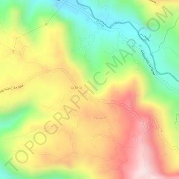
Name: La Bella topographic map, elevation, terrain.
Location: La Bella, Pereira, Risaralda, 66000012, Colombia (4.75338 -75.64533 4.77338 -75.62533)
Average elevation: 1,753 m
Minimum elevation: 1,547 m
Maximum elevation: 1,945 m
Other topographic maps
Click on a map to view its topography, its elevation and its terrain.