
Thank you for supporting this site ❤️
Make a donation
Make a donation
Gear up for your next adventure:
As an Amazon Associate, this site earns from qualifying purchases at no extra cost to you.
Tsetang topographic map
Click on the map to display elevation.
Thank you for supporting this site ❤️
Make a donation
Make a donation
Gear up for your next adventure:
As an Amazon Associate, this site earns from qualifying purchases at no extra cost to you.
About this map
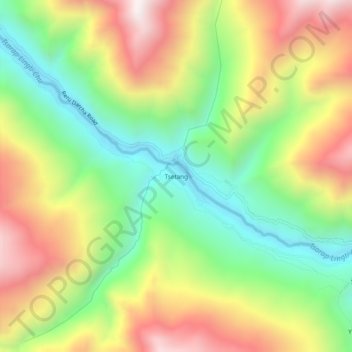
Name: Tsetang topographic map, elevation, terrain.
Location: Tsetang, Zanskar, Kargil District, Ladakh, India (33.22863 77.04628 33.26863 77.08628)
Average elevation: 4,190 m
Minimum elevation: 3,739 m
Maximum elevation: 4,751 m
Thank you for supporting this site ❤️
Make a donation
Make a donation
Gear up for your next adventure:
As an Amazon Associate, this site earns from qualifying purchases at no extra cost to you.