
Marazion topographic map
Click on the map to display elevation.
About this map
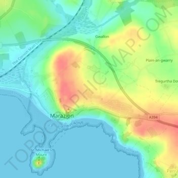
Name: Marazion topographic map, elevation, terrain.
Location: Marazion, Cornwall, England, United Kingdom (50.11793 -5.48251 50.13796 -5.44730)
Average elevation: 20 m
Minimum elevation: 0 m
Maximum elevation: 60 m
Cornwall trails, hiking, mountain biking, running and outdoor activities
Other topographic maps
Click on a map to view its topography, its elevation and its terrain.
Saint Michael's Mount
United Kingdom > England > Cornwall > Marazion > St Michael's Mount
Average elevation: 6 m