
Măgurele topographic map
Interactive map
Click on the map to display elevation.
About this map
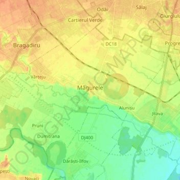
Name: Măgurele topographic map, elevation, terrain.
Location: Măgurele, Ilfov, Romania (44.31453 25.94839 44.38318 26.08648)
Average elevation: 76 m
Minimum elevation: 59 m
Maximum elevation: 90 m