Geolocate

Halford topographic map

Click on the map to display elevation.

About this map

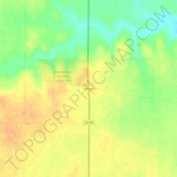
Name: Halford topographic map, elevation, terrain.

Location: Halford, Thomas County, Kansas, United States (39.35306 -100.88987 39.39306 -100.84987)

Average elevation: 935 m

Minimum elevation: 915 m

Maximum elevation: 948 m

Gear up for your next adventure:

🧵Survival Paracord - Multi-purpose cordage for emergency repairs and shelters
🎒Hiking Daypacks - Compact backpacks ideal for short hikes and excursions
🧦Merino Wool Hiking Socks - Moisture-wicking socks to prevent blisters during long mountain walks
📚UK Hiking Guidebooks - Detailed route descriptions for the Lake District, Peaks, and Highlands
🕶️Glacier Goggles - Maximum protection for high-altitude snow topography

As an Amazon Associate, this site earns from qualifying purchases at no extra cost to you.