
Penrhos topographic map
Interactive map
Click on the map to display elevation.
About this map
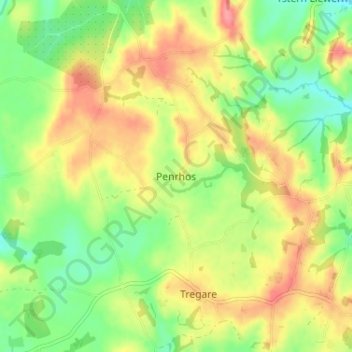
Name: Penrhos topographic map, elevation, terrain.
Location: Penrhos, Monmouthshire, Wales, NP15 2LG, United Kingdom (51.78096 -2.86947 51.82096 -2.82947)
Average elevation: 79 m
Minimum elevation: 43 m
Maximum elevation: 118 m
Monmouthshire trails, hiking, mountain biking, running and outdoor activities
Other topographic maps
Click on a map to view its topography, its elevation and its terrain.