
Rano Kau topographic map
Interactive map
Click on the map to display elevation.
About this map
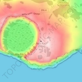
Name: Rano Kau topographic map, elevation, terrain.
Average elevation: 149 m
Minimum elevation: 0 m
Maximum elevation: 323 m
Other topographic maps
Click on a map to view its topography, its elevation and its terrain.
Easter Island
Chile > Valparaiso Region > Easter Island
Easter Island, Easter Island Province, Valparaiso Region, Chile
Average elevation: 48 m