
Tebessa topographic map
Interactive map
Click on the map to display elevation.
About this map
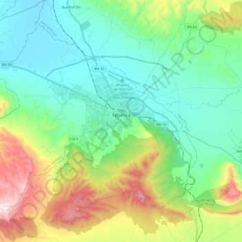
Name: Tebessa topographic map, elevation, terrain.
Location: Tebessa, Tébessa District, Tébessa, 12000, Algeria (35.31940 7.95945 35.47764 8.19517)
Average elevation: 1,030 m
Minimum elevation: 770 m
Maximum elevation: 1,700 m