
Clay Center topographic map
Interactive map
Click on the map to display elevation.
About this map
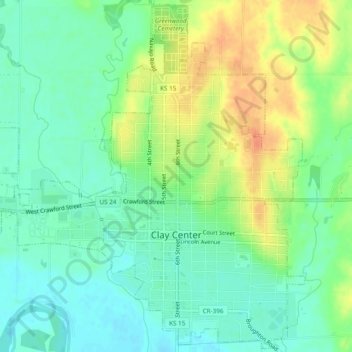
Name: Clay Center topographic map, elevation, terrain.
Location: Clay Center, Clay County, Kansas, États-Unis d'Amérique (39.36493 -97.15521 39.40123 -97.10726)
Average elevation: 374 m
Minimum elevation: 358 m
Maximum elevation: 399 m
Other topographic maps
Click on a map to view its topography, its elevation and its terrain.
Longford
États-Unis d'Amérique > Kansas > Clay County > Longford
Longford, Clay County, Kansas, États-Unis d'Amérique
Average elevation: 407 m