
Thank you for supporting this site ❤️
Make a donation
Make a donation
Gear up for your next adventure:
As an Amazon Associate, this site earns from qualifying purchases at no extra cost to you.
Saioa topographic map
Click on the map to display elevation.
Thank you for supporting this site ❤️
Make a donation
Make a donation
Gear up for your next adventure:
As an Amazon Associate, this site earns from qualifying purchases at no extra cost to you.
About this map
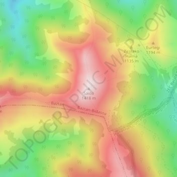
Name: Saioa topographic map, elevation, terrain.
Location: Saioa, Baztán, Baztan-Bidasoa, Navarra, España (43.04589 -1.55926 43.04599 -1.55916)
Average elevation: 1,098 m
Minimum elevation: 766 m
Maximum elevation: 1,412 m
Thank you for supporting this site ❤️
Make a donation
Make a donation
Gear up for your next adventure:
As an Amazon Associate, this site earns from qualifying purchases at no extra cost to you.