
Lac Orford topographic map
Interactive map
Click on the map to display elevation.
About this map
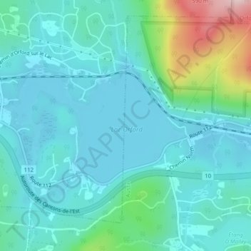
Name: Lac Orford topographic map, elevation, terrain.
Location: Lac Orford, Eastman, Memphrémagog, Estrie, Québec, Canada (45.28867 -72.28684 45.30112 -72.26011)
Average elevation: 333 m
Minimum elevation: 277 m
Maximum elevation: 582 m
Other topographic maps
Click on a map to view its topography, its elevation and its terrain.
Orford sur le lac
Orford sur le lac, Eastman, Memphrémagog, Estrie, Québec, Canada
Average elevation: 336 m