
Daisy topographic map
Interactive map
Click on the map to display elevation.
About this map
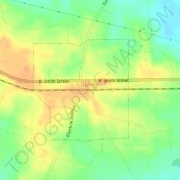
Name: Daisy topographic map, elevation, terrain.
Location: Daisy, Evans County, Georgia, United States (32.14320 -81.84467 32.15854 -81.82777)
Average elevation: 41 m
Minimum elevation: 21 m
Maximum elevation: 58 m
Other topographic maps
Click on a map to view its topography, its elevation and its terrain.