Geolocate

Ulverstone topographic map

Click on the map to display elevation.

About this map

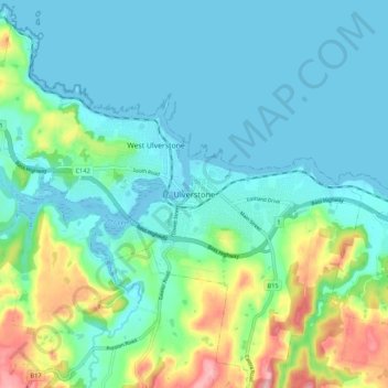
Name: Ulverstone topographic map, elevation, terrain.

Location: Ulverstone, Tasmania, Australia (-41.19718 146.13051 -41.11718 146.21051)

Average elevation: 37 m

Minimum elevation: -6 m

Maximum elevation: 165 m

Other topographic maps

Click on a map to view its topography, its elevation and its terrain.

Ulverstone

Australia > Tasmania > Ulverstone

Average elevation: 60 m

Gear up for your next adventure:

🎒Hiking Child Carriers - Explore the outdoors with the whole family safely
🥄Titanium Camping Sporks - The ultimate lightweight utensil for trail meals
Lightweight Solo Tents - Backpacking tents designed for wild camping in the UK highlands
🎒Backpack Rain Covers - Universal waterproof covers to protect your gear from downpours
🧢Waterproof Hiking Hats - Keep the rain off your face while studying topographic maps

As an Amazon Associate, this site earns from qualifying purchases at no extra cost to you.