Geolocate

Vasco Neto topographic map

Click on the map to display elevation.

About this map
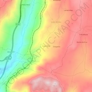
Name: Vasco Neto topographic map, elevation, terrain.

Location: Vasco Neto, João Antão, Guarda, Portugal (40.43038 -7.26659 40.47038 -7.22659)

Average elevation: 784 m

Minimum elevation: 525 m

Maximum elevation: 971 m

Gear up for your next adventure:

🥤Collapsible Water Bottles - Save space in your rucksack as you consume your water
🔋Solar Power Banks - Keep your GPS and phone charged during multi-day expeditions
🥄Titanium Camping Sporks - The ultimate lightweight utensil for trail meals
🎒Backpack Rain Covers - Universal waterproof covers to protect your gear from downpours
🦯Walking Poles - Supportive poles for long-distance walking

As an Amazon Associate, this site earns from qualifying purchases at no extra cost to you.