
Limuru topographic map
Click on the map to display elevation.
About this map
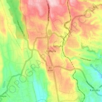
Name: Limuru topographic map, elevation, terrain.
Location: Limuru, Kiambu, Central Kenya, 00217, Kenya (-1.15979 36.59374 -1.07979 36.67374)
Average elevation: 2,239 m
Minimum elevation: 2,105 m
Maximum elevation: 2,379 m
Other topographic maps
Click on a map to view its topography, its elevation and its terrain.
Limuru
Most of the area of Limuru is now what was previously known as the "white highlands", a rich agricultural land south of the equator. The term "white highlands" derived from the British and other Europeans who realised the productive potential of this area and settled in large numbers with the support of the…
Average elevation: 2,254 m
Limuru
Limuru encompasses areas previously known as the "white highlands," a rich agricultural land south of the equator. The term "white highlands" derived from the British and other Europeans who realised the productive potential of this area and settled in large numbers with the support of the colonial government,…
Average elevation: 2,254 m