
Mont d'Ars topographic map
Interactive map
Click on the map to display elevation.
About this map
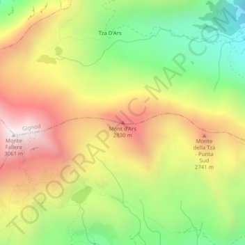
Name: Mont d'Ars topographic map, elevation, terrain.
Location: Mont d'Ars, Gignod, Aosta Valley, 11014, Italy (45.77671 7.21159 45.77681 7.21169)
Average elevation: 2,456 m
Minimum elevation: 1,913 m
Maximum elevation: 3,029 m