
Thank you for supporting this site ❤️
Make a donation
Make a donation
Gear up for your next adventure:
As an Amazon Associate, this site earns from qualifying purchases at no extra cost to you.
Missano topographic map
Click on the map to display elevation.
Thank you for supporting this site ❤️
Make a donation
Make a donation
Gear up for your next adventure:
As an Amazon Associate, this site earns from qualifying purchases at no extra cost to you.
About this map
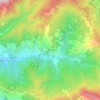
Name: Missano topographic map, elevation, terrain.
Location: Missano, Castiglione Chiavarese, Genova, Liguria, 19013, Italia (44.25458 9.51404 44.29458 9.55404)
Average elevation: 421 m
Minimum elevation: 134 m
Maximum elevation: 849 m
Thank you for supporting this site ❤️
Make a donation
Make a donation
Gear up for your next adventure:
As an Amazon Associate, this site earns from qualifying purchases at no extra cost to you.