
Thank you for supporting this site ❤️
Make a donation
Make a donation
Gear up for your next adventure:
As an Amazon Associate, this site earns from qualifying purchases at no extra cost to you.
Silverburn topographic map
Click on the map to display elevation.
Thank you for supporting this site ❤️
Make a donation
Make a donation
Gear up for your next adventure:
As an Amazon Associate, this site earns from qualifying purchases at no extra cost to you.
About this map
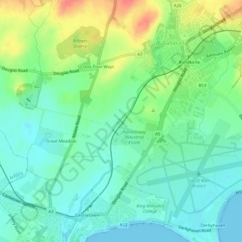
Name: Silverburn topographic map, elevation, terrain.
Location: Silverburn, Ballasalla, Malew, Rushen, Isle of Man (54.07491 -4.65282 54.10267 -4.63194)
Average elevation: 20 m
Minimum elevation: 0 m
Maximum elevation: 61 m
Thank you for supporting this site ❤️
Make a donation
Make a donation
Gear up for your next adventure:
As an Amazon Associate, this site earns from qualifying purchases at no extra cost to you.