
Tân Sơn District topographic map
Interactive map
Click on the map to display elevation.
About this map
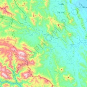
Name: Tân Sơn District topographic map, elevation, terrain.
Location: Tân Sơn District, Phu Tho Province, Vietnam (21.01504 104.81429 21.36546 105.11706)
Average elevation: 340 m
Minimum elevation: 16 m
Maximum elevation: 1,347 m
Other topographic maps
Click on a map to view its topography, its elevation and its terrain.