Geolocate

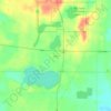
Cassopolis topographic map

Click on the map to display elevation.

About this map

Name: Cassopolis topographic map, elevation, terrain.

Location: Cassopolis, Cass County, Michigan, United States (41.89735 -86.03417 41.92268 -85.98603)

Average elevation: 272 m

Minimum elevation: 257 m

Maximum elevation: 292 m

Other topographic maps

Click on a map to view its topography, its elevation and its terrain.
Jones

United States > Michigan > Cass County > Newberg Township

Average elevation: 283 m

Allenton

United States > Michigan > Cass County > Mason Township

Average elevation: 245 m

Allenton

United States > Michigan > Cass County > Mason Township

Average elevation: 245 m

Harwood Lake

United States > Michigan > Cass County

Average elevation: 279 m

Gear up for your next adventure:

🧥Waterproof Hiking Jackets - Rain protection for walking in all weather conditions
👟Women's Trail Running Shoes - Agile footwear for fell running and technical trails
🧤Thermal Touchscreen Gloves - Stay warm while operating your GPS or smartphone camera
🧣Neck Gaiters - Versatile protection against wind and cold
🗺️Topographic Maps - Detailed maps showing elevation and terrain features

As an Amazon Associate, this site earns from qualifying purchases at no extra cost to you.