
Nordmalings kommun topographic map
Interactive map
Click on the map to display elevation.
About this map
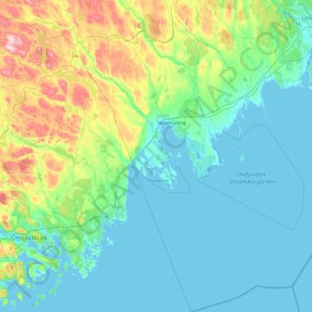
Name: Nordmalings kommun topographic map, elevation, terrain.
Location: Nordmalings kommun, Västerbotten County, Sweden (63.10199 18.80005 63.86816 20.25793)
Average elevation: 79 m
Minimum elevation: -3 m
Maximum elevation: 505 m
Other topographic maps
Click on a map to view its topography, its elevation and its terrain.