
Hồ Đông Quan topographic map
Interactive map
Click on the map to display elevation.
About this map
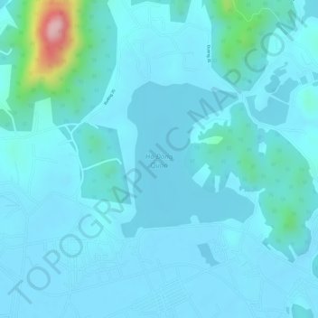
Name: Hồ Đông Quan topographic map, elevation, terrain.
Location: Hồ Đông Quan, Sóc Sơn District, Hanoi, Vietnam (21.25941 105.81537 21.27277 105.82763)
Average elevation: 37 m
Minimum elevation: 12 m
Maximum elevation: 233 m
Other topographic maps
Click on a map to view its topography, its elevation and its terrain.