Barton-under-Needwood topographic map
Interactive map
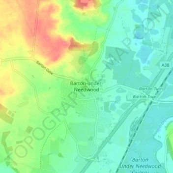
Click on the map to display elevation.
About this map
Name: Barton-under-Needwood topographic map, elevation, terrain.
Average elevation: 63 m
Minimum elevation: 42 m
Maximum elevation: 105 m

Click on the map to display elevation.
Name: Barton-under-Needwood topographic map, elevation, terrain.
Average elevation: 63 m
Minimum elevation: 42 m
Maximum elevation: 105 m