
Al `Abbas topographic map
Interactive map
Click on the map to display elevation.
About this map
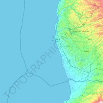
Name: Al `Abbas topographic map, elevation, terrain.
Location: Al `Abbas, Tartus, Syria (34.49667 35.53000 35.13667 36.17000)
Average elevation: 121 m
Minimum elevation: 0 m
Maximum elevation: 1,561 m
Other topographic maps
Click on a map to view its topography, its elevation and its terrain.