
Klieken topographic map
Interactive map
Click on the map to display elevation.
About this map
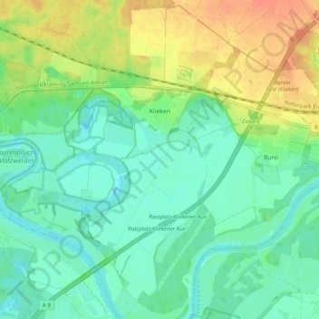
Name: Klieken topographic map, elevation, terrain.
Average elevation: 68 m
Minimum elevation: 53 m
Maximum elevation: 96 m
Other topographic maps
Click on a map to view its topography, its elevation and its terrain.
Bräsen
Deutschland > Sachsen-Anhalt > Wittenberg > Coswig (Anhalt)
Bräsen, Coswig (Anhalt), Wittenberg, Sachsen-Anhalt, Deutschland
Average elevation: 104 m
Köselitz
Deutschland > Sachsen-Anhalt > Wittenberg > Coswig (Anhalt) > Köselitz
Köselitz, Coswig (Anhalt), Wittenberg, Sachsen-Anhalt, Deutschland
Average elevation: 131 m